


Maps
Maps
Please note that the TimeRef website is currently being redesigned.
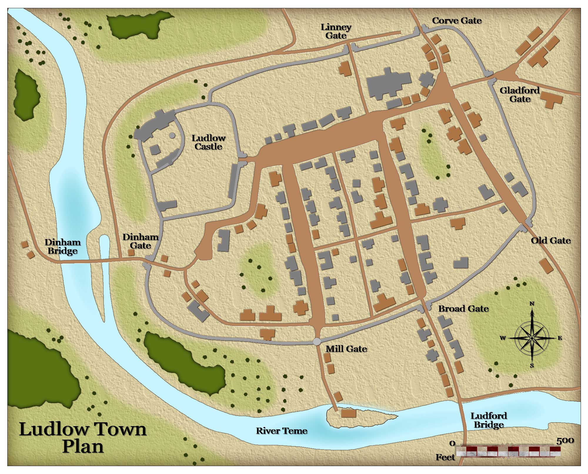
Map of Medieval Ludlow
This imaginative map shows the size and layout of medieval Ludlow. The town was surrounded by a stone wall with several fortified gates. The castle occupies the north-west corner of the town. Its northern and western sides are protected by steep cliffs and a ditch was dug to protect its southern and eastern sides. To the south of the town a mill was constructed driven by the flow of the River Teme.

More maps
Map Index Page
Saxons and Angles
Invasion RoutesAreas Controlled in 550
Kingdoms in 7th Century
England in 1065
Vikings
Viking Invasions
William the Conqueror
Key battles in 1066Invasion of England
Possessions in 1087
By Date
Invasion France (1346)Invasion France (1415)
War of the Roses
Battle Maps
Locations by Area
Area map - North WalesArea map - Wales
Area map - South East
Area map - East
Area map - South West
Area map - North
Area map - Scotland Central
Area map - Scotland North
Area map - Midlands
Area map - South